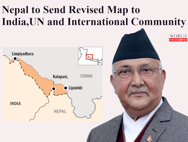
Nepal to Send Revised Controversial Map to India, UN & International Community
The government of Nepal plans to send its recently revised map to the
international community, Google and India, said a minister.
Indian territories of Kalapani, Limpiyadhura, and Lipulekh will be included in the revised map, the minister added. “We are soon delivering the revised map incorporating Kalapani, LipuLekh and Limpiyadhura to the international community,” said Minister for Land Management, Padma Aryal. The map was passed by 258 votes in the country’s 275-seat parliament.
Nepal Prime Minister KP Sharma Oli has faced strong opposition within his ruling Nepal Communist Party over the redrawing of borders with India. A rival faction, led by party executive chairperson Pushpa Kamal Dahal Prachanda, has said Oli’s anti-India remarks were neither ‘politically correct nor diplomatically appropriate.’
India also said that the move is contrary to the bilateral
understanding to resolve the outstanding boundary issues through
diplomatic dialogue and "such artificial enlargement of territorial
claims will not be accepted by India".
Nepal and India have an open border of more than 16,000 km. The two countries are in dispute over several of these places. Kalapani, LipuLekh and Susta are among the territories at the center of the dispute. India and Nepal have been discussing the issue for a long time.
There is no doubt that the release of a new political map will escalate
the dispute between two countries, but it has also put pressure on the
Indian side to sit for talks. This move has broken the status quo that
had prevailed since the Sugauli Treaty which states that Lipulekh, Kalapani, and Limpiyadhura belong to Nepal.
Nepal should be ready to face India and India should be ready to hold serious bilateral dialogues to resolve this issue.
If you find this post useful, help it get spread by sharing with a friend or on Twitter or Facebook. Thank you!


Comments
Post a Comment